
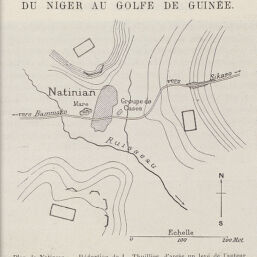
Plan de Natinian
Permalink
https://digital.library.illinois.edu/items/37662510-e946-0133-1d3d-0050569601ca-c
This item is in the public domain.
Descriptive Information
| Title | Plan de Natinian |
| Creator | Thuillier, Louis |
| Date | 1891 |
| Dimensions | 8 x 8 cm |
| Cartographic Scale | 17 cm. = 100 m. |
| Coverage-Spatial | Africa, West |
| Genre | Maps |
| Language | French |
| Source | Le Tour du Monde, Premier Semestre, 1891, p. 29 |
| Physical Location | Professor Thomas Bassett Personal Collection |
| Map ID | afm0003196 |
| Rights | No Copyright - United States |
| Rights Description | This item is in the public domain. |
| Collection Title | Maps of Africa to 1900 |
| Repository | Rare Book & Manuscript Library |
| Type | Cartographic material |
| Collection | Maps of Africa to 1900 |
Download Options
|
Plan de Natinian |
Contact us
for questions and to provide feedback.