
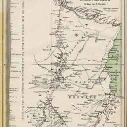
Originalkarte von Joachim Graf Pfeil's Reiseroute durch Useguha 18.März bis 8 Mai 1887
Permalink
https://digital.library.illinois.edu/items/378afb50-e946-0133-1d3d-0050569601ca-3
This item is in the public domain.
Descriptive Information
| Title | Originalkarte von Joachim Graf Pfeil's Reiseroute durch Useguha 18.März bis 8 Mai 1887 |
| Creator | Hassenstein, Bruno |
| Date | 1888 |
| Dimensions | 24.8 x 19.5 cm |
| Place of Publication | Germany |
| Cartographic Scale | 1:1,000,000 |
| Notes | Relief shown by hachures. Includes 1 inset elevation profile. |
| Coverage-Spatial | Ethiopia |
| Subject | |
| Genre | Maps |
| Language | German |
| Color | Printed color |
| Technique | Lithography |
| Source | Petermanns geographische Mitteilungen, V. 34, plate 1. |
| Physical Location | stx |
| Map No. in Bassett and Scheven Bibliography | 1317 |
| Call Number | Q_910_5PE |
| Map ID | afm0001317 |
| Rights | No Copyright - United States |
| Rights Description | This item is in the public domain. |
| Collection Title | Maps of Africa to 1900 |
| Repository | Rare Book & Manuscript Library |
| Type | Cartographic material |
| Collection | Maps of Africa to 1900 |
Download Options
|
Originalkarte von Joachim Graf Pfeil's Reiseroute durch Useguha 18.März bis 8 Mai 1887 |
Contact us
for questions and to provide feedback.