
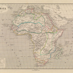
Africa
Permalink
https://digital.library.illinois.edu/items/37b69c60-e946-0133-1d3d-0050569601ca-c
This item is in the public domain.
Descriptive Information
| Title | Africa |
| Creator | Allodi, Pietro |
| Date | 1867 |
| Dimensions | 32. 5 x 42 cm |
| Cartographic Scale | 1:28,750,000 |
| Coverage-Spatial | Africa |
| Genre | Maps |
| Source | Atlante di Geografia Universale Cronologico, Storio, Statistico e Letterario. |
| Physical Location | Professor Thomas Bassett Personal Collection |
| Bibliography | Rumsey Collection No. 4453.047 |
| Map ID | afm0003173 |
| Rights | No Copyright - United States |
| Rights Description | This item is in the public domain. |
| Collection Title | Maps of Africa to 1900 |
| Repository | Rare Book & Manuscript Library |
| Type | Cartographic material |
| Collection | Maps of Africa to 1900 |
Download Options
Contact us
for questions and to provide feedback.