
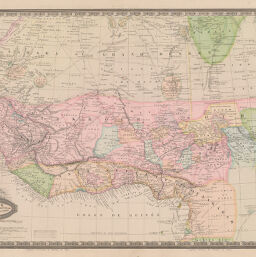
Afrique Occidentale et Central comprenant le Sahara, le Takrour, la Sénégambie, l'Ouankârah, et les Iles de Cap Vert.
Permalink
https://digital.library.illinois.edu/items/388eb9b0-e946-0133-1d3d-0050569601ca-a
This item is in the public domain.
Descriptive Information
| Title | Afrique Occidentale et Central comprenant le Sahara, le Takrour, la Sénégambie, l'Ouankârah, et les Iles de Cap Vert. |
| Creator | Garnier, F. A., 1803-1863 |
| Date | 1860 |
| Dimensions | 35 x 50 cm |
| Place of Publication | Paris (France) |
| Cartographic Scale | 1:9,500,000 |
| Coverage-Spatial | Africa, West |
| Genre | Maps |
| Language | French |
| Source | Atlas Sphéroïdal & Universel de Géographie. Paris, 1862. |
| Physical Location | Professor Thomas Bassett Personal Collection |
| Bibliography | Rumsey Collection No. 5023.046 |
| Map ID | afm0003074 |
| Rights | No Copyright - United States |
| Rights Description | This item is in the public domain. |
| Collection Title | Maps of Africa to 1900 |
| Repository | Rare Book & Manuscript Library |
| Type | Cartographic material |
| Collection | Maps of Africa to 1900 |
Download Options
|
Afrique Occidentale et Central comprenant le Sahara, le Takrour, la Sénégambie, l'Ouankârah, et les Iles de Cap Vert. |
Contact us
for questions and to provide feedback.