
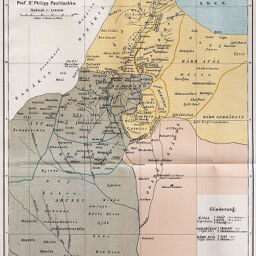
Übersicht über die Vertheilung der Westlichen Somâl- und der Nord-Östl. Galla-Stämme entworfen und gezichnet von Prof. Dr. Philipp Paulitschke
Permalink
https://digital.library.illinois.edu/items/38e56af0-e946-0133-1d3d-0050569601ca-6
This item is in the public domain.
Descriptive Information
| Title | Übersicht über die Vertheilung der Westlichen Somâl- und der Nord-Östl. Galla-Stämme entworfen und gezichnet von Prof. Dr. Philipp Paulitschke |
| Creator | Paulitschke, Philipp, 1854-1899 |
| Date | 1885 |
| Dimensions | 32 x 24 cm |
| Place of Publication | Austria |
| Cartographic Scale | 1:2,000000 |
| Coverage-Spatial | Horn of Africa |
| Subject | |
| Genre | Maps |
| Language | German |
| Color | Printed color |
| Technique | Lithography |
| Source | Mitteilungen der Österreichischen Geographischen Gesellschaft, V. 28, after p. 590. |
| Physical Location | stx |
| Map No. in Bassett and Scheven Bibliography | 1278 |
| Call Number | 910_5GEOW |
| Map ID | afm0001278 |
| Rights | No Copyright - United States |
| Rights Description | This item is in the public domain. |
| Collection Title | Maps of Africa to 1900 |
| Repository | Rare Book & Manuscript Library |
| Type | Cartographic material |
| Collection | Maps of Africa to 1900 |
Download Options
|
Übersicht über die Vertheilung der Westlichen Somâl- und der Nord-Östl. Galla-Stämme entworfen und gezichnet von Prof. Dr. Philipp Paulitschke |
Contact us
for questions and to provide feedback.