
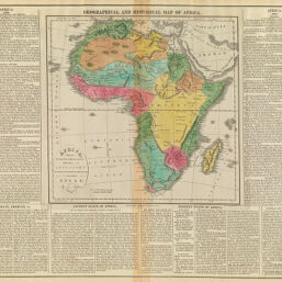
Geographical, and Historical Map of Africa. Africa: Drawn the best Authorities, for the Illustration of Lavoisne's Genealogical, Historical, Chronological, & Geographical Atlas, by J. Aspin. Improved to 1821.
Permalink
https://digital.library.illinois.edu/items/39260f00-e946-0133-1d3d-0050569601ca-9
This item is in the public domain.
Descriptive Information
| Title | Geographical, and Historical Map of Africa. Africa: Drawn the best Authorities, for the Illustration of Lavoisne's Genealogical, Historical, Chronological, & Geographical Atlas, by J. Aspin. Improved to 1821. |
| Creator | Aspin, Jehoshaphat, active 18th century-19th century |
| Date | 1821 |
| Dimensions | 41.5 x 51 cm |
| Place of Publication | Philadelphia (Pa.) |
| Cartographic Scale | 1:2,900,000 |
| Notes |
|
| Coverage-Spatial | Africa |
| Genre | Maps |
| Language | English |
| Source | Lavoisne's Genealogical, Historical, Chronological, and Geographical Atlas. 3rd Edition, Philadelphia: M. Carey & Son, 1821. |
| Physical Location | Professor Thomas Bassett Personal Collection |
| Bibliography | Rumsey Collection No. 1642066 |
| Map ID | afm0003036 |
| Rights | No Copyright - United States |
| Rights Description | This item is in the public domain. |
| Collection Title | Maps of Africa to 1900 |
| Repository | Rare Book & Manuscript Library |
| Type | Cartographic material |
| Collection | Maps of Africa to 1900 |
Download Options
|
Geographical, and Historical Map of Africa. Africa: Drawn the best Authorities, for the Illustration of Lavoisne's Genealogical, Historical, Chronological, & Geographical Atlas, by J. Aspin. Improved to 1821. |
Contact us
for questions and to provide feedback.