
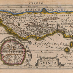
Guinea
Permalink
https://digital.library.illinois.edu/items/39669b70-e946-0133-1d3d-0050569601ca-d
This item is in the public domain.
Descriptive Information
| Title | Guinea |
| Creator | Keere, Pieter van den, 1571-approximately 1646 |
| Date | 1606 |
| Dimensions | 13.5 x 18.5 cm |
| Cartographic Scale | 1:19,500,000 |
| Coverage-Spatial | Africa, West |
| Genre | Maps |
| Source | French edition of the Mercator-Hondius Atlas, Paris, 1606, p. 573. |
| Physical Location | Professor Thomas Bassett Personal Collection |
| Bibliography | Bassett and Scheven, No. 2115 |
| Map ID | afm0003004 |
| Rights | No Copyright - United States |
| Rights Description | This item is in the public domain. |
| Collection Title | Maps of Africa to 1900 |
| Repository | Rare Book & Manuscript Library |
| Type | Cartographic material |
| Collection | Maps of Africa to 1900 |
Download Options
Contact us
for questions and to provide feedback.