
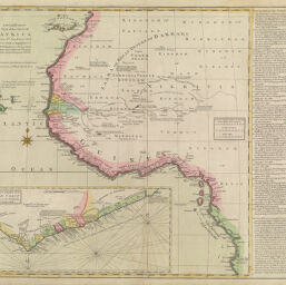
A New and Correct Map of the Coast of Africa...
Permalink
https://digital.library.illinois.edu/items/39dd5180-e946-0133-1d3d-0050569601ca-f
This item is in the public domain.
Descriptive Information
| Title | A New and Correct Map of the Coast of Africa... |
| Creator | John & Carington Bowles |
| Date | 1770 |
| Dimensions | 48.5 x 60 cm |
| Place of Publication | London (England) |
| Cartographic Scale | 1:10,000,000 |
| Notes | Inset of, "A correct chart of the Gold Coast" Based on D'Anville's 1749 map. On linen backing. |
| Coverage-Spatial | Africa, West |
| Genre | Maps |
| Language | English |
| Physical Location | Professor Thomas Bassett Personal Collection |
| Map ID | afm0003118 |
| Rights | No Copyright - United States |
| Rights Description | This item is in the public domain. |
| Collection Title | Maps of Africa to 1900 |
| Repository | Rare Book & Manuscript Library |
| Type | Cartographic material |
| Collection | Maps of Africa to 1900 |
Download Options
|
A New and Correct Map of the Coast of Africa... |
Contact us
for questions and to provide feedback.