
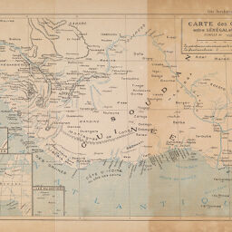
Carte des Contrées entre Sénégal et Niger
Permalink
https://digital.library.illinois.edu/items/3a46c3d0-e946-0133-1d3d-0050569601ca-5
This item is in the public domain.
Descriptive Information
| Title | Carte des Contrées entre Sénégal et Niger |
| Creator | Frey, Lt. Col. |
| Date | 1890 |
| Dimensions | 22.5 x 32 cm |
| Place of Publication | Paris (France) |
| Cartographic Scale | 1:10,000,000 |
| Coverage-Spatial | Africa, West |
| Genre | Maps |
| Language | French |
| Source | Côte Occidentale d'Afrique. Paris: Marpon & Flammarion, 1890, opposite p. 40. |
| Physical Location | Professor Thomas Bassett Personal Collection |
| Map ID | afm0003095 |
| Rights | No Copyright - United States |
| Rights Description | This item is in the public domain. |
| Collection Title | Maps of Africa to 1900 |
| Repository | Rare Book & Manuscript Library |
| Type | Cartographic material |
| Collection | Maps of Africa to 1900 |
Download Options
|
Carte des Contrées entre Sénégal et Niger |
Contact us
for questions and to provide feedback.