
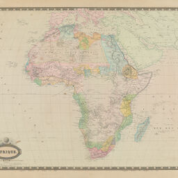
Afrique
Permalink
https://digital.library.illinois.edu/items/3a7de830-e946-0133-1d3d-0050569601ca-0
This item is in the public domain.
Descriptive Information
| Title | Afrique |
| Creator | Garnier, F. A., 1803-1863 |
| Date | 1860 |
| Dimensions | 50 x 68 cm |
| Place of Publication | Paris (France) |
| Cartographic Scale | 1:19,500,000 |
| Coverage-Spatial | Africa |
| Genre | Maps |
| Source | Atlas Sphéroïdal & Universel de Géographie, Paris, 1862. |
| Physical Location | Professor Thomas Bassett Personal Collection |
| Bibliography | Rumsey Collection No. 5023.043 |
| Map ID | afm0003073 |
| Rights | No Copyright - United States |
| Rights Description | This item is in the public domain. |
| Collection Title | Maps of Africa to 1900 |
| Repository | Rare Book & Manuscript Library |
| Type | Cartographic material |
| Collection | Maps of Africa to 1900 |
Download Options
|
Afrique |
Contact us
for questions and to provide feedback.