


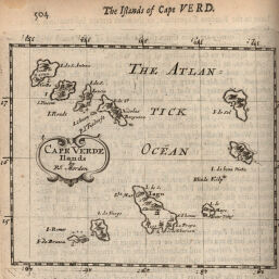
Cape Verde Ilands
Permalink
https://digital.library.illinois.edu/items/3b819e20-e946-0133-1d3d-0050569601ca-0
This item is in the public domain.
Descriptive Information
| Title | Cape Verde Ilands |
| Creator | Morden, Robert, approximately 1650-1703 |
| Date | 1688 |
| Dimensions | 10.3 x 12.4 cm |
| Cartographic Scale | 1:4,000,000 |
| Coverage-Spatial | Islands--Africa |
| Genre | Maps |
| Source | Geography Rectified, p. 504. |
| Physical Location | rbx |
| Map No. in Bassett and Scheven Bibliography | 2400 |
| Call Number | X910M81G2 |
| Map ID | afm0002400 |
| Rights | No Copyright - United States |
| Rights Description | This item is in the public domain. |
| Collection Title | Maps of Africa to 1900 |
| Repository | Rare Book & Manuscript Library |
| Type | Cartographic material |
| Collection | Maps of Africa to 1900 |
Download Options
|
Cape Verde Ilands |
Contact us
for questions and to provide feedback.