
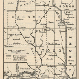
New Franco-German Boundary in West Africa
Permalink
https://digital.library.illinois.edu/items/3baad0d0-e946-0133-1d3d-0050569601ca-9
This item is in the public domain.
Descriptive Information
| Title | New Franco-German Boundary in West Africa |
| Creator | George Philip & Son |
| Date | 1897 |
| Dimensions | 15.5 x 11 cm |
| Place of Publication | England |
| Cartographic Scale | 1:4,000,000 |
| Notes | Non-wood relief print. |
| Coverage-Spatial | Africa, West |
| Genre | Maps |
| Language | English |
| Color | Bitonal |
| Source | The Geographical Journal, V. 10, p. 636. |
| Physical Location | stx |
| Map No. in Bassett and Scheven Bibliography | 2373 |
| Call Number | 910_5GJ |
| Map ID | afm0002373 |
| Rights | No Copyright - United States |
| Rights Description | This item is in the public domain. |
| Collection Title | Maps of Africa to 1900 |
| Repository | Rare Book & Manuscript Library |
| Type | Cartographic material |
| Collection | Maps of Africa to 1900 |
Download Options
|
New Franco-German Boundary in West Africa |
Contact us
for questions and to provide feedback.