
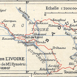
Côte de l'Ivoire Itinéraire de Mr. J. Eysséric 1896-97
Permalink
https://digital.library.illinois.edu/items/3bb483f0-e946-0133-1d3d-0050569601ca-2
This item is in the public domain.
Descriptive Information
| Title | Côte de l'Ivoire Itinéraire de Mr. J. Eysséric 1896-97 |
| Creator | Chesneau, Marius |
| Date | 1897 |
| Dimensions | 5.5 x 8.5 cm |
| Place of Publication | France |
| Cartographic Scale | 1:2,000,000 |
| Notes | Part of the same plate as ID No. 2369, 991, 2096, 2095, 1526, 1564. |
| Coverage-Spatial | Africa, West |
| Genre | Maps |
| Language | French |
| Color | Printed color |
| Technique | Lithography |
| Source | Année cartographique, 1890-1912/13. |
| Physical Location | stx |
| Map No. in Bassett and Scheven Bibliography | 2368 |
| Call Number | Q_912AN74 |
| Map ID | afm0002368 |
| Rights | No Copyright - United States |
| Rights Description | This item is in the public domain. |
| Collection Title | Maps of Africa to 1900 |
| Repository | Rare Book & Manuscript Library |
| Type | Cartographic material |
| Collection | Maps of Africa to 1900 |
Download Options
|
Côte de l'Ivoire Itinéraire de Mr. J. Eysséric 1896-97 |
Contact us
for questions and to provide feedback.