
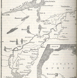
Upper Niger Region
Permalink
https://digital.library.illinois.edu/items/3bc80b90-e946-0133-1d3d-0050569601ca-5
This item is in the public domain.
Descriptive Information
| Title | Upper Niger Region |
| Creator | Bluzet, Lieut |
| Date | 1896 |
| Dimensions | 13 x 10.6 cm |
| Place of Publication | England |
| Cartographic Scale | 1:1,700,000 |
| Notes | Includes location map of West Africa. |
| Coverage-Spatial | Mali |
| Subject | |
| Genre | Maps |
| Language | English |
| Color | Bitonal |
| Technique | Lithography |
| Source | The Geographical Journal, V. 7, p. 98. |
| Physical Location | stx |
| Map No. in Bassett and Scheven Bibliography | 2363 |
| Call Number | 910_5GJ |
| Map ID | afm0002363 |
| Rights | No Copyright - United States |
| Rights Description | This item is in the public domain. |
| Collection Title | Maps of Africa to 1900 |
| Repository | Rare Book & Manuscript Library |
| Type | Cartographic material |
| Collection | Maps of Africa to 1900 |
Download Options
|
Upper Niger Region |
Contact us
for questions and to provide feedback.