
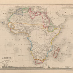
Africa
Permalink
https://digital.library.illinois.edu/items/3bf81510-e946-0133-1d3d-0050569601ca-6
This item is in the public domain.
Descriptive Information
| Title | Africa |
| Creator | Petermann, A. (August), 1822-1878 |
| Date | 1853 |
| Dimensions | 20.5 x 26 cm |
| Place of Publication | Great Britain |
| Cartographic Scale | 1:38,000,000 |
| Coverage-Spatial | Africa |
| Genre | Maps |
| Color | Hand colored |
| Technique | Etched or engraved |
| Source | Descriptive Atlas, plate 34. |
| Physical Location | mar |
| Map No. in Bassett and Scheven Bibliography | 215 |
| Call Number | Q_912P44D1853 |
| Map ID | afm0000215 |
| Rights | No Copyright - United States |
| Rights Description | This item is in the public domain. |
| Collection Title | Maps of Africa to 1900 |
| Repository | Rare Book & Manuscript Library |
| Type | Cartographic material |
| Collection | Maps of Africa to 1900 |
Download Options
Contact us
for questions and to provide feedback.