
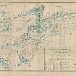
Carte de la région de Tombouctou
Permalink
https://digital.library.illinois.edu/items/3c2c3040-e946-0133-1d3d-0050569601ca-e
This item is in the public domain.
Descriptive Information
| Title | Carte de la région de Tombouctou |
| Creator | Bluzet, Lieut |
| Date | 1895 |
| Dimensions | 47.9 x 57.3 cm |
| Place of Publication | France |
| Cartographic Scale | 1:500,000 |
| Notes | Needs repair. |
| Coverage-Spatial | Africa, West |
| Genre | Maps |
| Language | French |
| Color | Printed color |
| Source | Bulletin de la Société de géographie, ser. 7, V. 16, between pp. 404-405. |
| Physical Location | stx |
| Map No. in Bassett and Scheven Bibliography | 2345 |
| Call Number | 910_6SOGEASER_7 |
| Map ID | afm0002345 |
| Rights | No Copyright - United States |
| Rights Description | This item is in the public domain. |
| Collection Title | Maps of Africa to 1900 |
| Repository | Rare Book & Manuscript Library |
| Type | Cartographic material |
| Collection | Maps of Africa to 1900 |
Download Options
|
Carte de la région de Tombouctou |
Contact us
for questions and to provide feedback.