
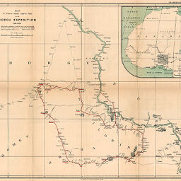
Map to illustrate Captain Lugard's Paper on the Borgu Expedition 1894-1895
Permalink
https://digital.library.illinois.edu/items/3c330980-e946-0133-1d3d-0050569601ca-c
This item is in the public domain.
Descriptive Information
| Title | Map to illustrate Captain Lugard's Paper on the Borgu Expedition 1894-1895 |
| Creator | Lugard, F. D. (Frederick Dealtry), Sir, 1858-1945 |
| Date | 1895 |
| Dimensions | 41.5 x 49.5 cm |
| Place of Publication | England |
| Cartographic Scale | 1:1,250,000 |
| Notes | Relief shown by hachures. Includes 1 inset map (scale 1:25,000,000): Sketch map of Western Equatorial Africa. |
| Coverage-Spatial | Borno State (Nigeria) |
| Subject | |
| Genre | Maps |
| Language | English |
| Color | Printed color |
| Source | The Geographical Journal, V. 6, between pp. 300-301. |
| Physical Location | stx |
| Map No. in Bassett and Scheven Bibliography | 2347 |
| Call Number | 910_5GJ |
| Map ID | afm0002347 |
| Rights | No Copyright - United States |
| Rights Description | This item is in the public domain. |
| Collection Title | Maps of Africa to 1900 |
| Repository | Rare Book & Manuscript Library |
| Type | Cartographic material |
| Collection | Maps of Africa to 1900 |
Download Options
|
Map to illustrate Captain Lugard's Paper on the Borgu Expedition 1894-1895 |
Contact us
for questions and to provide feedback.