
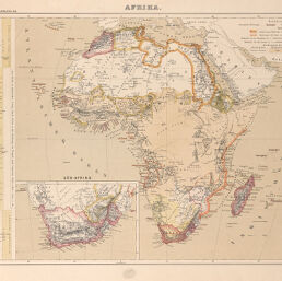
Afrika
Permalink
https://digital.library.illinois.edu/items/3c720110-e946-0133-1d3d-0050569601ca-2
This item is in the public domain.
Descriptive Information
| Title | Afrika |
| Creator | Lange, Henry, 1821-1893 |
| Date | 1867 |
| Dimensions | 30.5 x 44 cm |
| Place of Publication | Germany |
| Cartographic Scale | 1:30,000,000 |
| Notes | Has inset map South Africa. |
| Coverage-Spatial | Africa |
| Genre | Maps |
| Color | Printed color |
| Source | Geographischer Handatlas über alle Theile der Erde, plate 29. |
| Physical Location | maos |
| Map No. in Bassett and Scheven Bibliography | 253 |
| Call Number | F_912L26G1867 |
| Map ID | afm0000253 |
| Rights | No Copyright - United States |
| Rights Description | This item is in the public domain. |
| Collection Title | Maps of Africa to 1900 |
| Repository | Rare Book & Manuscript Library |
| Type | Cartographic material |
| Collection | Maps of Africa to 1900 |
Download Options
Contact us
for questions and to provide feedback.