
Africa
Permalink
https://digital.library.illinois.edu/items/3ca50660-e946-0133-1d3d-0050569601ca-a
This item is in the public domain.
Descriptive Information
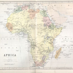
| Title | Africa |
| Creator | Bartholomew, J. G. (John George), 1860-1920 |
| Date | 1872 |
| Dimensions | 21.2 x 25.7 cm |
| Place of Publication | England |
| Cartographic Scale | 1:41,100,000 |
| Notes | Relief shown by hachures and spot heights. Routes of exploration labeled and dated. |
| Coverage-Spatial | Africa |
| Subject | |
| Genre | Maps |
| Color | Printed color |
| Technique | Lithography |
| Source | Gallery of Geography, V. 2, p. 929. |
| Physical Location | stx |
| Map No. in Bassett and Scheven Bibliography | 266 |
| Call Number | 910M63G1872 |
| Map ID | afm0000266 |
| Rights | No Copyright - United States |
| Rights Description | This item is in the public domain. |
| Collection Title | Maps of Africa to 1900 |
| Repository | Rare Book & Manuscript Library |
| Type | Cartographic material |
| Collection | Maps of Africa to 1900 |
Download Options
Contact us
for questions and to provide feedback.