
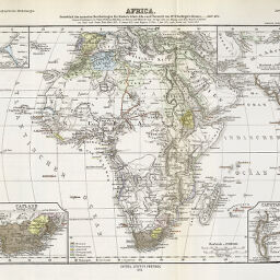
Africa
Permalink
https://digital.library.illinois.edu/items/3cab0350-e946-0133-1d3d-0050569601ca-4
This item is in the public domain.
Descriptive Information
| Title | Africa |
| Creator | Perthes, Justus |
| Date | 1874 |
| Dimensions | 21.3 x 27.8 cm |
| Cartographic Scale | 1:45,000,000 |
| Notes | Relief shown by hachures. Includes 4 inset maps: Capland (1:25,000,000) -- Capestadt (1:1,500,000) -- [Dakar] (1:5,000.000) -- [part of the Red Sea] (1:5,000,000). |
| Coverage-Spatial | Africa |
| Subject | |
| Genre | Maps |
| Color | Hand colored |
| Technique | Lithography |
| Source | Petermanns geographische Mitteilungen, V. 20, plate 14. |
| Physical Location | stx |
| Map No. in Bassett and Scheven Bibliography | 270 |
| Call Number | Q_910_5PE |
| Map ID | afm0000270 |
| Rights | No Copyright - United States |
| Rights Description | This item is in the public domain. |
| Collection Title | Maps of Africa to 1900 |
| Repository | Rare Book & Manuscript Library |
| Type | Cartographic material |
| Collection | Maps of Africa to 1900 |
Download Options
Contact us
for questions and to provide feedback.