
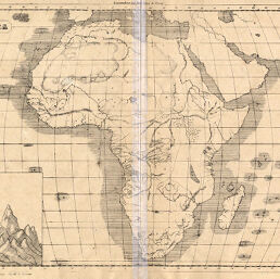
Africa
Permalink
https://digital.library.illinois.edu/items/3cd0efb0-e946-0133-1d3d-0050569601ca-b
This item is in the public domain.
Descriptive Information
| Title | Africa |
| Creator | Gnocchi, Giacomo |
| Date | 1876 |
| Dimensions | 27.3 x 37.7 cm |
| Place of Publication | Italy |
| Cartographic Scale | 1:32,000,000 |
| Notes | Outline map. Relief shown by hachures. |
| Coverage-Spatial | Africa |
| Subject | |
| Genre | |
| Color | Bitonal |
| Technique | Lithography |
| Source | Nuovo atlante, plate 4. |
| Physical Location | stx |
| Map No. in Bassett and Scheven Bibliography | 280 |
| Call Number | Q_912G53N |
| Map ID | afm0000280 |
| Rights | No Copyright - United States |
| Rights Description | This item is in the public domain. |
| Collection Title | Maps of Africa to 1900 |
| Repository | Rare Book & Manuscript Library |
| Type | Cartographic material |
| Collection | Maps of Africa to 1900 |
Download Options
Contact us
for questions and to provide feedback.