
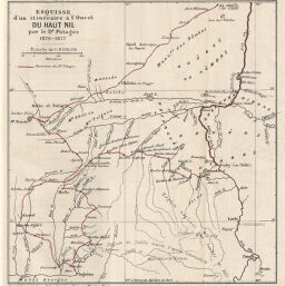
Esquisse d'un itinéraire à l'Ouest du Haut Nil par le Dr Potagos 1876-1877
Permalink
https://digital.library.illinois.edu/items/3cffc570-e946-0133-1d3d-0050569601ca-5
This item is in the public domain.
Descriptive Information
| Title | Esquisse d'un itinéraire à l'Ouest du Haut Nil par le Dr Potagos 1876-1877 |
| Creator | Bulletin de la Société de Géographie de Paris |
| Date | 1880 |
| Dimensions | 15 x 14.3 cm |
| Place of Publication | France |
| Cartographic Scale | 1:8,000,000 |
| Coverage-Spatial | Africa |
| Genre | Maps |
| Language | French |
| Color | Printed color |
| Technique | Lithography |
| Source | Bulletin de la Société de géographie, ser. 6, V. 20, after p. 592. |
| Physical Location | stx |
| Map No. in Bassett and Scheven Bibliography | 306 |
| Call Number | 910_6SOGEASER_6 |
| Map ID | afm0000306 |
| Rights | No Copyright - United States |
| Rights Description | This item is in the public domain. |
| Collection Title | Maps of Africa to 1900 |
| Repository | Rare Book & Manuscript Library |
| Type | Cartographic material |
| Collection | Maps of Africa to 1900 |
Download Options
|
Esquisse d'un itinéraire à l'Ouest du Haut Nil par le Dr Potagos 1876-1877 |
Contact us
for questions and to provide feedback.