
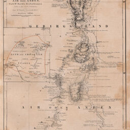
Karte vom Tuareg-Lande Air oder Asben. Nach Dr. Barth's Beobachtungen
Permalink
https://digital.library.illinois.edu/items/3db3b080-e946-0133-1d3d-0050569601ca-a
This item is in the public domain.
Descriptive Information
| Title | Karte vom Tuareg-Lande Air oder Asben. Nach Dr. Barth's Beobachtungen |
| Creator | Petermann, A. (August), 1822-1878 |
| Date | 1857 |
| Dimensions | 24.5 x 19 cm |
| Cartographic Scale | 1:100,000 |
| Coverage-Spatial | Africa, West |
| Genre | Maps |
| Language | German |
| Color | Hand colored |
| Source | Petermanns geographische Mitteilungen, V. 3, plate 11. |
| Physical Location | stx |
| Map No. in Bassett and Scheven Bibliography | 2218 |
| Call Number | Q_910_5PE |
| Map ID | afm0002218 |
| Rights | No Copyright - United States |
| Rights Description | This item is in the public domain. |
| Collection Title | Maps of Africa to 1900 |
| Repository | Rare Book & Manuscript Library |
| Type | Cartographic material |
| Collection | Maps of Africa to 1900 |
Download Options
|
Karte vom Tuareg-Lande Air oder Asben. Nach Dr. Barth's Beobachtungen |
Contact us
for questions and to provide feedback.