
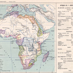
Afrique au 1er janvier 1890
Permalink
https://digital.library.illinois.edu/items/3dc22040-e946-0133-1d3d-0050569601ca-8
This item is in the public domain.
Descriptive Information
| Title | Afrique au 1er janvier 1890 |
| Creator | Chesneau, Marius |
| Date | 1890 |
| Dimensions | 14 x 15.5 cm |
| Place of Publication | France |
| Cartographic Scale | 1:60,000,000 |
| Notes | Part of the same plate as ID No. 378. |
| Coverage-Spatial | Africa |
| Genre | Maps |
| Language | French |
| Color | Printed color |
| Technique | Lithography |
| Source | Année cartographique, 1890-1912/13. |
| Physical Location | stx |
| Map No. in Bassett and Scheven Bibliography | 377 |
| Call Number | Q_912AN74 |
| Map ID | afm0000377 |
| Rights | No Copyright - United States |
| Rights Description | This item is in the public domain. |
| Collection Title | Maps of Africa to 1900 |
| Repository | Rare Book & Manuscript Library |
| Type | Cartographic material |
| Collection | Maps of Africa to 1900 |
Download Options
|
Afrique au 1er janvier 1890 |
Contact us
for questions and to provide feedback.