
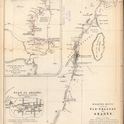
Map to Illustrate the Paper on the Progress of the African Mission
Permalink
https://digital.library.illinois.edu/items/3de13660-e946-0133-1d3d-0050569601ca-9
This item is in the public domain.
Descriptive Information
| Title | Map to Illustrate the Paper on the Progress of the African Mission |
| Creator | Petermann, A. (August), 1822-1878 |
| Date | 1851 |
| Dimensions | 25.8 x 20.3 cm |
| Place of Publication | Great Britain |
| Cartographic Scale | 1:2,800,000 |
| Coverage-Spatial | Africa, West |
| Genre | Maps |
| Language | English |
| Source | Journal of the Royal Geographic Society, V. 21, between pp. 130-131. |
| Physical Location | rbx |
| Map No. in Bassett and Scheven Bibliography | 2209 |
| Call Number | 910_6ROJ |
| Map ID | afm0002209 |
| Rights | No Copyright - United States |
| Rights Description | This item is in the public domain. |
| Collection Title | Maps of Africa to 1900 |
| Repository | Rare Book & Manuscript Library |
| Type | Cartographic material |
| Collection | Maps of Africa to 1900 |
Download Options
|
Map to Illustrate the Paper on the Progress of the African Mission |
Contact us
for questions and to provide feedback.