
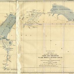
Sketch Map of Vice-Consul Sharpe's route from Lake Tanganyika to Lake Mweru & the River Luapula 1892
Permalink
https://digital.library.illinois.edu/items/3e218260-e946-0133-1d3d-0050569601ca-6
This item is in the public domain.
Descriptive Information
| Title | Sketch Map of Vice-Consul Sharpe's route from Lake Tanganyika to Lake Mweru & the River Luapula 1892 |
| Creator | Sharpe, Alfred, 1853-1935 |
| Date | 1892 |
| Dimensions | 29.1 x unknown. |
| Place of Publication | England |
| Cartographic Scale | 1:1,010,000 |
| Notes | Portion of map is illegible due to damage. |
| Coverage-Spatial | Luapula River (Zambia and Congo) |
| Subject | |
| Genre | Maps |
| Language | English |
| Color | Printed color |
| Technique | Lithography |
| Source | The Geographical Journal, V. 1, between pp. 576-577. |
| Physical Location | stx |
| Map No. in Bassett and Scheven Bibliography | 411 |
| Call Number | 910_5GJ |
| Map ID | afm0000411 |
| Rights | No Copyright - United States |
| Rights Description | This item is in the public domain. |
| Collection Title | Maps of Africa to 1900 |
| Repository | Rare Book & Manuscript Library |
| Type | Cartographic material |
| Collection | Maps of Africa to 1900 |
Download Options
|
Sketch Map of Vice-Consul Sharpe's route from Lake Tanganyika to Lake Mweru & the River Luapula 1892 |
Contact us
for questions and to provide feedback.