
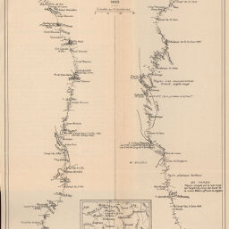
Rgion du Nord du Congo Franais
Permalink
https://digital.library.illinois.edu/items/3f1ded10-e946-0133-1d3d-0050569601ca-4
This item is in the public domain.
Descriptive Information
| Title | Rgion du Nord du Congo Franais |
| Creator | Armand Colin (Firm) |
| Date | 1893 |
| Dimensions | 21.5 x 29.2 cm |
| Cartographic Scale | 1:800,000 |
| Coverage-Spatial | Africa, Central |
| Genre | Maps |
| Color | Bitonal |
| Source | Annales de géographie : bulletin de la Société de géographie, V. 5, between pp. 128-129. |
| Physical Location | stx |
| Map No. in Bassett and Scheven Bibliography | 2051 |
| Call Number | 910_5AN |
| Map ID | afm0002051 |
| Rights | No Copyright - United States |
| Rights Description | This item is in the public domain. |
| Collection Title | Maps of Africa to 1900 |
| Repository | Rare Book & Manuscript Library |
| Type | Cartographic material |
| Collection | Maps of Africa to 1900 |
Download Options
|
Rgion du Nord du Congo Franais |
Contact us
for questions and to provide feedback.