
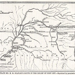
Map to Illustrate Mr. H.M. Stanley's Route in the Relief of Emin Bey
Permalink
https://digital.library.illinois.edu/items/3fb09060-e946-0133-1d3d-0050569601ca-0
This item is in the public domain.
Descriptive Information
| Title | Map to Illustrate Mr. H.M. Stanley's Route in the Relief of Emin Bey |
| Creator | Manchester Geographical Society |
| Date | 1888 |
| Dimensions | 10.3 x 15 cm |
| Place of Publication | England |
| Cartographic Scale | 1:17,000,000 |
| Coverage-Spatial | Congo River |
| Subject | |
| Genre | Maps |
| Language | English |
| Color | Bitonal |
| Technique | Lithography |
| Source | The Journal of the Manchester Geographical Society, V. 3, p. 255 |
| Physical Location | stx |
| Map No. in Bassett and Scheven Bibliography | 1997 |
| Call Number | 910_6MA |
| Map ID | afm0001997 |
| Rights | No Copyright - United States |
| Rights Description | This item is in the public domain. |
| Collection Title | Maps of Africa to 1900 |
| Repository | Rare Book & Manuscript Library |
| Type | Cartographic material |
| Collection | Maps of Africa to 1900 |
Download Options
|
Map to Illustrate Mr. H.M. Stanley's Route in the Relief of Emin Bey |
Contact us
for questions and to provide feedback.