
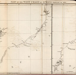
Part of the West Coast of Africa Surveyed in 1835
Permalink
https://digital.library.illinois.edu/items/40d35080-e946-0133-1d3d-0050569601ca-8
This item is in the public domain.
Descriptive Information
| Title | Part of the West Coast of Africa Surveyed in 1835 |
| Creator | Royal Geographical Society (Great Britain) |
| Date | 1836 |
| Dimensions | 19.4 x 37.2 cm |
| Place of Publication | England |
| Cartographic Scale | 1:3,000,000 |
| Coverage-Spatial | Africa, North |
| Genre | Maps |
| Language | English |
| Source | Journal of the Royal Geographic Society, V. 6, between pp. 310-311. |
| Physical Location | rbx |
| Map No. in Bassett and Scheven Bibliography | 686 |
| Call Number | 910_6ROJ |
| Map ID | afm0000686 |
| Rights | No Copyright - United States |
| Rights Description | This item is in the public domain. |
| Collection Title | Maps of Africa to 1900 |
| Repository | Rare Book & Manuscript Library |
| Type | Cartographic material |
| Collection | Maps of Africa to 1900 |
Download Options
|
Part of the West Coast of Africa Surveyed in 1835 |
Contact us
for questions and to provide feedback.