


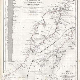
Karte der Sahara von Ghardaja bis Tuat Originalkarte von H. Duveyrier's Reise im Grenzgebiet der Französischen Sahara von Ghardaja nach El Golea
Permalink
https://digital.library.illinois.edu/items/4120de50-e946-0133-1d3d-0050569601ca-5
This item is in the public domain.
Descriptive Information
| Title | Karte der Sahara von Ghardaja bis Tuat Originalkarte von H. Duveyrier's Reise im Grenzgebiet der Französischen Sahara von Ghardaja nach El Golea |
| Creator | Duveyrier, Henri, 1840-1892 |
| Date | 1860 |
| Extent | 1 map in 2 sections |
| Dimensions | 24.3 x 19.1 cm |
| Place of Publication | Germany |
| Cartographic Scale | 1:4,000000 |
| Notes | Inset of profile showing Duveyrier's route. |
| Coverage-Spatial | Sahara |
| Subject | |
| Genre | Maps |
| Language | German |
| Color | Hand colored |
| Technique | Lithography |
| Source | Petermanns geographische Mitteilungen, V. 6, plate 3. |
| Physical Location | stx |
| Map No. in Bassett and Scheven Bibliography | 719 |
| Call Number | Q_910_5PE |
| Map ID | afm0000719 |
| Rights | No Copyright - United States |
| Rights Description | This item is in the public domain. |
| Collection Title | Maps of Africa to 1900 |
| Repository | Rare Book & Manuscript Library |
| Type | Cartographic material |
| Collection | Maps of Africa to 1900 |
Download Options
|
Karte der Sahara von Ghardaja bis Tuat Originalkarte von H. Duveyrier's Reise im Grenzgebiet der Französischen Sahara von Ghardaja nach El Golea |
Contact us
for questions and to provide feedback.