
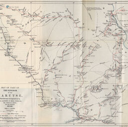
Map of Part of the Kingdom of the Marutse, from Surveys and Explorations by Capt. Alfred St. Hill Gibbons, Mr. Percy C. Reid, and Capt. Bertrand
Permalink
https://digital.library.illinois.edu/items/412ec7a0-e946-0133-1d3d-0050569601ca-3
This item is in the public domain.
Descriptive Information
| Title | Map of Part of the Kingdom of the Marutse, from Surveys and Explorations by Capt. Alfred St. Hill Gibbons, Mr. Percy C. Reid, and Capt. Bertrand |
| Creator | Ravenstein, Ernst Georg, 1834-1913 |
| Date | 1896 |
| Dimensions | 31.8 x 38.2 cm |
| Place of Publication | Switzerland |
| Cartographic Scale | 1:1,000,000 |
| Notes | Relief shown by hachures. Gibbons's, Reid's and Bertrand's routes indicated in red. |
| Coverage-Spatial | Zambia |
| Subject | |
| Genre | Maps |
| Language | English |
| Color | Printed color |
| Technique | Lithography |
| Source | Le Globe : bulletin et mémoires de la Société de géographie de Genève, V. 36, Mémoires, between pp. 61-62. |
| Physical Location | stx |
| Map No. in Bassett and Scheven Bibliography | 1793 |
| Call Number | 910_5GLO |
| Map ID | afm0001793 |
| Rights | No Copyright - United States |
| Rights Description | This item is in the public domain. |
| Collection Title | Maps of Africa to 1900 |
| Repository | Rare Book & Manuscript Library |
| Type | Cartographic material |
| Collection | Maps of Africa to 1900 |
Download Options
|
Map of Part of the Kingdom of the Marutse, from Surveys and Explorations by Capt. Alfred St. Hill Gibbons, Mr. Percy C. Reid, and Capt. Bertrand |
Contact us
for questions and to provide feedback.