
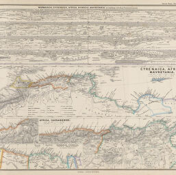
Cyrenaica, Africa, and Mavretania
Permalink
https://digital.library.illinois.edu/items/416cfa50-e946-0133-1d3d-0050569601ca-e
This item is in the public domain.
Descriptive Information
| Title | Cyrenaica, Africa, and Mavretania |
| Creator | Menke, Theodorus |
| Date | 1865 |
| Dimensions | 21.2 x 40.6 cm |
| Place of Publication | Germany |
| Cartographic Scale | 1:9,759,000 |
| Notes | Multiple maps in one plate. |
| Coverage-Spatial | Africa, North |
| Genre | Maps |
| Color | Hand colored |
| Technique | Lithography |
| Source | Spruner-Menke atlas antiquus, plate 31. |
| Physical Location | maos |
| Map No. in Bassett and Scheven Bibliography | 745 |
| Call Number | F_911SP89S |
| Map ID | afm0000745 |
| Rights | No Copyright - United States |
| Rights Description | This item is in the public domain. |
| Collection Title | Maps of Africa to 1900 |
| Repository | Rare Book & Manuscript Library |
| Type | Cartographic material |
| Collection | Maps of Africa to 1900 |
Download Options
|
Cyrenaica, Africa, and Mavretania |
Contact us
for questions and to provide feedback.