
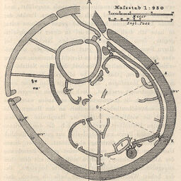
Plan der Ruinen von Simbabye
Permalink
https://digital.library.illinois.edu/items/41ab9d60-e946-0133-1d3d-0050569601ca-b
This item is in the public domain.
Descriptive Information
| Title | Plan der Ruinen von Simbabye |
| Creator | Swan, R. M. W. (Robert McNair Wilson), 1858-1904 |
| Date | 1892 |
| Dimensions | 11.2 x 9 cm |
| Place of Publication | Germany |
| Cartographic Scale | 1:950,000 |
| Notes | Title from text. |
| Coverage-Spatial | Zimbabwe |
| Subject | |
| Genre | Maps |
| Language | German |
| Color | Bitonal |
| Technique | Lithography |
| Source | Petermanns geographische Mitteilungen, V. 38, p. 285. |
| Physical Location | stx |
| Map No. in Bassett and Scheven Bibliography | 1767 |
| Call Number | Q_910_5PE |
| Map ID | afm0001767 |
| Rights | No Copyright - United States |
| Rights Description | This item is in the public domain. |
| Collection Title | Maps of Africa to 1900 |
| Repository | Rare Book & Manuscript Library |
| Type | Cartographic material |
| Collection | Maps of Africa to 1900 |
Download Options
|
Plan der Ruinen von Simbabye |
Contact us
for questions and to provide feedback.