
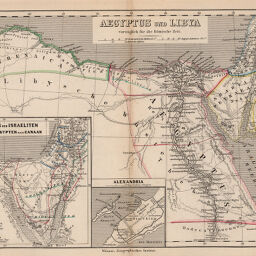
Aegyptus und Libya vorzüglich für die Römische Zeit
Permalink
https://digital.library.illinois.edu/items/41b1b6a0-e946-0133-1d3d-0050569601ca-8
This item is in the public domain.
Descriptive Information
| Title | Aegyptus und Libya vorzüglich für die Römische Zeit |
| Creator | Kiepert, Heinrich, 1818-1899 |
| Date | 1868 |
| Dimensions | 20.2 x 25.8 cm |
| Place of Publication | Germany |
| Cartographic Scale | 1:6,200,000 |
| Coverage-Spatial | Africa, North |
| Genre | Maps |
| Language | German |
| Color | Hand colored |
| Technique | Etched or engraved |
| Source | Historisch-geographischer, plate 4. |
| Physical Location | mar |
| Map No. in Bassett and Scheven Bibliography | 763 |
| Call Number | 912_3K54HI |
| Map ID | afm0000763 |
| Rights | No Copyright - United States |
| Rights Description | This item is in the public domain. |
| Collection Title | Maps of Africa to 1900 |
| Repository | Rare Book & Manuscript Library |
| Type | Cartographic material |
| Collection | Maps of Africa to 1900 |
Download Options
|
Aegyptus und Libya vorzüglich für die Römische Zeit |
Contact us
for questions and to provide feedback.