


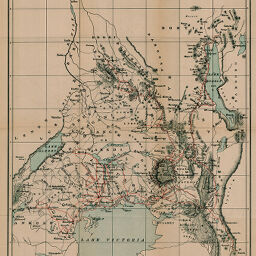
Map of Uganda Protectorate and the Territories to the North
Permalink
https://digital.library.illinois.edu/items/43a17e10-e946-0133-1d3d-0050569601ca-1
This item is in the public domain.
Descriptive Information
| Title | Map of Uganda Protectorate and the Territories to the North |
| Creator | Macdonald, James Ronald Leslie, Sir, 1862-1927 |
| Date | 1898 |
| Dimensions | 32.4 x 36.2 cm |
| Place of Publication | England |
| Cartographic Scale | 1:2,500,000 |
| Notes | Relief shown by hachures. |
| Coverage-Spatial | Great Lakes (Africa) |
| Subject | |
| Genre | Maps |
| Language | English |
| Color | Printed color |
| Technique | Lithography |
| Source | The Geographical Journal, V. 14, between pp. 240-241. |
| Physical Location | stx |
| Map No. in Bassett and Scheven Bibliography | 1548 |
| Call Number | 910_5GJ |
| Map ID | afm0001548 |
| Rights | No Copyright - United States |
| Rights Description | This item is in the public domain. |
| Collection Title | Maps of Africa to 1900 |
| Repository | Rare Book & Manuscript Library |
| Type | Cartographic material |
| Collection | Maps of Africa to 1900 |
Download Options
|
Map of Uganda Protectorate and the Territories to the North |
Contact us
for questions and to provide feedback.