
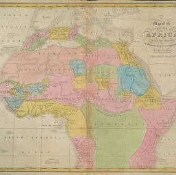
Map of the Interior of Africa Drawn and Engraved to Illustrate Hart's Geographical Exercises
Permalink
https://digital.library.illinois.edu/items/43a87180-e946-0133-1d3d-0050569601ca-6
This item is in the public domain.
Descriptive Information
| Title | Map of the Interior of Africa Drawn and Engraved to Illustrate Hart's Geographical Exercises |
| Creator | Vance, D. H. (David H.) |
| Date | 1828 |
| Dimensions | 32.5 x 37.5 cm |
| Place of Publication | New York (N.Y.) |
| Cartographic Scale | 1:21,500,000 |
| Coverage-Spatial | Africa |
| Genre | Maps |
| Language | English |
| Source | Joseph C. Hart, A Modern Atlas, New York. |
| Physical Location | Professor Thomas Bassett Personal Collection |
| Map ID | afm0003179 |
| Rights | No Copyright - United States |
| Rights Description | This item is in the public domain. |
| Collection Title | Maps of Africa to 1900 |
| Repository | Rare Book & Manuscript Library |
| Type | Cartographic material |
| Collection | Maps of Africa to 1900 |
Download Options
|
Map of the Interior of Africa Drawn and Engraved to Illustrate Hart's Geographical Exercises |
Contact us
for questions and to provide feedback.