
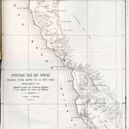
Presqu'île du Sinaï esquisse d'une carte de la Côte Ouest...
Permalink
https://digital.library.illinois.edu/items/44b4ecb0-e946-0133-1d3d-0050569601ca-b
This item is in the public domain.
Descriptive Information
| Title | Presqu'île du Sinaï esquisse d'une carte de la Côte Ouest... |
| Creator | Fourtau, M.R. |
| Date | 1898 |
| Dimensions | 45.2 x 27.7 cm |
| Place of Publication | Egypt |
| Cartographic Scale | 1:500,000 |
| Notes | Relief shown by contours. |
| Coverage-Spatial | Egypt |
| Subject | |
| Genre | Maps |
| Language | French |
| Color | Bitonal |
| Technique | Lithography |
| Source | Bulletin de la Société de géographie d'Égypte, V. 5, between pp. 36-37. |
| Physical Location | stos |
| Map No. in Bassett and Scheven Bibliography | 1001 |
| Call Number | 910_5SOCG |
| Map ID | afm0001001 |
| Rights | No Copyright - United States |
| Rights Description | This item is in the public domain. |
| Collection Title | Maps of Africa to 1900 |
| Repository | Rare Book & Manuscript Library |
| Type | Cartographic material |
| Collection | Maps of Africa to 1900 |
Download Options
|
Presqu'île du Sinaï esquisse d'une carte de la Côte Ouest... |
Contact us
for questions and to provide feedback.