
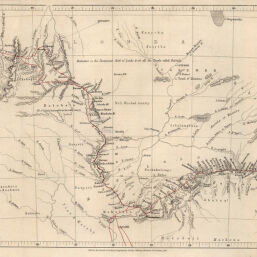
Map to illustrate Dr. Livingstones Route across Africa, Constructed from his Astronomical Observations, Bearings, Estimated Distances, Sketches, etc.
Permalink
https://digital.library.illinois.edu/items/4538cb50-e946-0133-1d3d-0050569601ca-2
This item is in the public domain.
Descriptive Information
| Title | Map to illustrate Dr. Livingstones Route across Africa, Constructed from his Astronomical Observations, Bearings, Estimated Distances, Sketches, etc. |
| Creator | Arrowsmith, John, 1790-1873 |
| Date | 1857 |
| Dimensions | 19.6 x 41.1 cm |
| Cartographic Scale | 1:6,500,000 |
| Coverage-Spatial | Africa, Central |
| Genre | Maps |
| Language | English |
| Source | Journal of the Royal Geographic Society, V. 27, between pp. 348-349. |
| Physical Location | rbx |
| Map No. in Bassett and Scheven Bibliography | 1846 |
| Call Number | 910_6ROJ (Online resource, http://www_library_uiuc_edu/orr/results_php?resid=35994) |
| Map ID | afm0001846 |
| Rights | No Copyright - United States |
| Rights Description | This item is in the public domain. |
| Collection Title | Maps of Africa to 1900 |
| Repository | Rare Book & Manuscript Library |
| Type | Cartographic material |
| Collection | Maps of Africa to 1900 |
Download Options
|
Map to illustrate Dr. Livingstones Route across Africa, Constructed from his Astronomical Observations, Bearings, Estimated Distances, Sketches, etc. |
Contact us
for questions and to provide feedback.