
Croquis de Voyage de M. Emile Gautier
Permalink
https://digital.library.illinois.edu/items/457a7b90-e946-0133-1d3d-0050569601ca-b
This item is in the public domain.
Descriptive Information
| Title | Croquis de Voyage de M. Emile Gautier |
| Creator | Gautier, E. F. (Emile Félix), 1864-1940 |
| Date | 1894 |
| Dimensions | 27.3 x 33.6 cm |
| Place of Publication | France |
| Cartographic Scale | 1:3,500,000 |
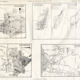
| Notes | Six maps on 1 sheet: Géologie -- Orographie-Végétation-Population -- Hypsométrie -- Itinéraires. |
| Coverage-Spatial | Madagascar |
| Subject | |
| Genre | Maps |
| Language | French |
| Color | Bitonal |
| Technique | Lithography |
| Source | Annales de géographie : bulletin de la Société de géographie, V. 3, between pp. 532-533. |
| Physical Location | stx |
| Map No. in Bassett and Scheven Bibliography | 1460 |
| Call Number | 910_5AN |
| Map ID | afm0001460 |
| Rights | No Copyright - United States |
| Rights Description | This item is in the public domain. |
| Collection Title | Maps of Africa to 1900 |
| Repository | Rare Book & Manuscript Library |
| Type | Cartographic material |
| Collection | Maps of Africa to 1900 |
Download Options
|
Croquis de Voyage de M. Emile Gautier |
Contact us
for questions and to provide feedback.