
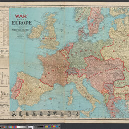
War map of Europe
Permalink
https://digital.library.illinois.edu/items/4585b5b0-b096-0136-5269-0050569601ca-f
No Copyright - United States
Descriptive Information
| Title | War map of Europe |
| Contributor | |
| Scale | Scale approximately 1:3,379,200 |
| Coordinates | (W 12⁰--E 34⁰/N 62⁰--N 37⁰) |
| Place of Publication | New York (N.Y.) |
| Publisher | World Syndicate Publishing Company |
| Date of Publication | 1914 |
| Extent | 1 map |
| Dimensions | 84 x 97 cm, on sheet 92 x 120 cm |
| Notes |
|
| Coverage-Spatial | Europe |
| Language | English |
| Subject | World War, 1914-1918 |
| Genre | Maps |
| Rights Description | No Copyright - United States |
| Type | Cartographic material |
| Repository | Map Library |
| Local Bib ID | 7993131 |
| Collection Title | World War I Maps |
| Collection | World War I Maps |
Download Options
|
War map of Europe |
Contact us
for questions and to provide feedback.