


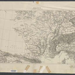
France
Permalink
https://digital.library.illinois.edu/items/45932cc0-b096-0136-5269-0050569601ca-b
No Copyright - United States
Descriptive Information
| Title | France |
| Creator | American Geographical Society of New York |
| Scale | Scale 1:3,000,000 |
| Coordinates | (W 10⁰--E 15⁰/N 52⁰--N 42⁰) |
| Place of Publication | New York (N.Y.) |
| Publisher | American Geographical Society of New York |
| Date of Publication | 1920-1929 |
| Extent | 1 map |
| Dimensions | 38 x 64 cm |
| Notes |
|
| Coverage-Spatial | France |
| Language | English |
| Genre | Maps |
| Rights Description | No Copyright - United States |
| Type | Cartographic material |
| Repository | Map Library |
| Local Bib ID | 3998982 |
| Collection Title | World War I Maps |
| Collection | World War I Maps |
Download Options
Contact us
for questions and to provide feedback.