
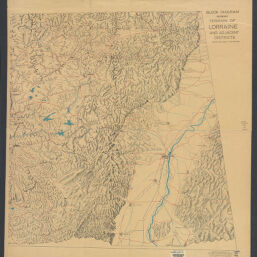
Block diagram showing terrain of Lorraine and adjacent districts
Permalink
https://digital.library.illinois.edu/items/45ac21b0-b096-0136-5269-0050569601ca-f
No Copyright - United States
Descriptive Information
| Title | Block diagram showing terrain of Lorraine and adjacent districts |
| Creator | American Geographical Society of New York |
| Scale | Scale [ca. 1:171,000]. Vertical scale [ca. 1:12,000]. About 1 in. = 1000 ft. |
| Place of Publication | New York (N.Y.) |
| Publisher | American Geographical Society of New York |
| Date of Publication | 1918 |
| Extent | 1 map on 2 sheets |
| Dimensions | 84 x 161 cm, sheets 97 x 92 cm |
| Notes |
|
| Coverage-Spatial | Lorraine (France) |
| Language | English |
| Genre | Maps |
| Rights Description | No Copyright - United States |
| Type | Cartographic material |
| Repository | Map Library |
| Local Bib ID | 3999392 |
| Collection Title | World War I Maps |
| Collection | World War I Maps |
Download Options
|
3999392-001 | |

|
3999392-002 |
Contact us
for questions and to provide feedback.