
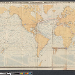
Chart of the world on Mercator's projection, showing submarine cables and connections, and also tracks for full-powered steam vessels
Permalink
https://digital.library.illinois.edu/items/45b93bb0-b096-0136-5269-0050569601ca-e
No Copyright - United States
Descriptive Information
| Title | Chart of the world on Mercator's projection, showing submarine cables and connections, and also tracks for full-powered steam vessels |
| Creator | United States. Hydrographic Office |
| Contributor | National Geographic Society (U.S.) |
| Scale | Scale approximately 1:37,000,000 ; |
| Coordinates | (W 180⁰--E 180⁰/N 72⁰--S 69⁰) |
| Place of Publication | Washington (D.C.) |
| Publisher | [National Geographic Society] |
| Date of Publication | 1905 |
| Extent | 1 map |
| Dimensions | 61 x 112 cm, folded to 23 x 15 cm |
| Notes |
|
| Language | English |
| Subject | |
| Genre | |
| Rights Description | No Copyright - United States |
| Type | Cartographic material |
| Repository | Map Library |
| Local Bib ID | 7995715 |
| Collection Title | World War I Maps |
| Collection | World War I Maps |
Download Options
|
Chart of the world on Mercator's projection, showing submarine cables and connections, and also tracks for full-powered steam vessels |
Contact us
for questions and to provide feedback.