


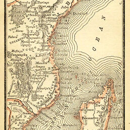
Map of Madagascar Southeast Africa
Permalink
https://digital.library.illinois.edu/items/46302d60-e946-0133-1d3d-0050569601ca-6
This item is in the public domain.
Descriptive Information
| Title | Map of Madagascar Southeast Africa |
| Creator | Alden, John B. (John Berry), 1847-1924 |
| Date | 1887 |
| Dimensions | 12.5 x 7.1 cm |
| Place of Publication | United States |
| Cartographic Scale | 1:31,000,000 |
| Notes | Relief shown by hachures. |
| Coverage-Spatial | Madagascar |
| Subject | |
| Genre | Maps |
| Language | English |
| Color | Printed color |
| Technique | Lithography |
| Source | Handy Atlas, p. 53. |
| Physical Location | stx |
| Map No. in Bassett and Scheven Bibliography | 1299 |
| Call Number | 912AL2H |
| Map ID | afm0001299 |
| Rights | No Copyright - United States |
| Rights Description | This item is in the public domain. |
| Collection Title | Maps of Africa to 1900 |
| Repository | Rare Book & Manuscript Library |
| Type | Cartographic material |
| Collection | Maps of Africa to 1900 |
Download Options
|
Map of Madagascar Southeast Africa |
Contact us
for questions and to provide feedback.