


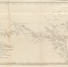
Map of Nyassi or the Great Lake of Southern Africa with the Country between it & the Eastern Coast
Permalink
https://digital.library.illinois.edu/items/46a52d40-e946-0133-1d3d-0050569601ca-7
This item is in the public domain.
Descriptive Information
| Title | Map of Nyassi or the Great Lake of Southern Africa with the Country between it & the Eastern Coast |
| Creator | Cooley, William Desborough, -1883 |
| Date | 1845 |
| Dimensions | 21 x 37.7 cm |
| Place of Publication | England |
| Cartographic Scale | 1:8,500,000 |
| Coverage-Spatial | Africa, Eastern |
| Genre | Maps |
| Source | Journal of the Royal Geographic Society, V. 15, after p. 385. |
| Physical Location | rbx |
| Map No. in Bassett and Scheven Bibliography | 1088 |
| Call Number | 910_6ROJ (Online resource, http://www_library_uiuc_edu/orr/results_php?resid=35994) |
| Map ID | afm0001088 |
| Rights | No Copyright - United States |
| Rights Description | This item is in the public domain. |
| Collection Title | Maps of Africa to 1900 |
| Repository | Rare Book & Manuscript Library |
| Type | Cartographic material |
| Collection | Maps of Africa to 1900 |
Download Options
|
Map of Nyassi or the Great Lake of Southern Africa with the Country between it & the Eastern Coast |
Contact us
for questions and to provide feedback.