
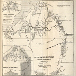
Itinéraire à Madagascar Cart levée par Emile Gautier 10 Août-14 Octobre 1892
Permalink
https://digital.library.illinois.edu/items/46dfc100-e946-0133-1d3d-0050569601ca-2
This item is in the public domain.
Descriptive Information
| Title | Itinéraire à Madagascar Cart levée par Emile Gautier 10 Août-14 Octobre 1892 |
| Creator | Hansen, Jules, 1849-1931 |
| Date | 1892 |
| Dimensions | 17.1 x 16.4 cm |
| Place of Publication | France |
| Cartographic Scale | 1:2,000,000 |
| Notes | Relief shown by hachures and spot heights. Includes 2 inset maps: Croquis géologique -- Exquisse Hypsométrique. |
| Coverage-Spatial | Madagascar |
| Subject | |
| Genre | Maps |
| Language | French |
| Color | Bitonal |
| Technique | Lithography |
| Source | Annales de géographie : bulletin de la Société de géographie, V. 2, between pp. 364-365. |
| Physical Location | stx |
| Map No. in Bassett and Scheven Bibliography | 1401 |
| Call Number | 910_5AN |
| Map ID | afm0001401 |
| Rights | No Copyright - United States |
| Rights Description | This item is in the public domain. |
| Collection Title | Maps of Africa to 1900 |
| Repository | Rare Book & Manuscript Library |
| Type | Cartographic material |
| Collection | Maps of Africa to 1900 |
Download Options
|
Itinéraire à Madagascar Cart levée par Emile Gautier 10 Août-14 Octobre 1892 |
Contact us
for questions and to provide feedback.