
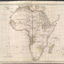
A Map of Africa Drawn & Engraved from D'Anville's Two-Sheet Map
Permalink
https://digital.library.illinois.edu/items/481b7540-c278-0135-4a00-0050569601ca-0
This item is in the public domain.
Descriptive Information
| Title | A Map of Africa Drawn & Engraved from D'Anville's Two-Sheet Map |
| Creator | Harrison, John |
| Date | 1791 |
| Dimensions | 50.3 x 71.3 cm |
| Place of Publication | London (England) |
| Cartographic Scale | 1:18,250,000 |
| Coverage-Spatial | Africa |
| Genre | Maps |
| Source | D'Anville's atlas containing a map of the world, the world in twelve maps and twelve maps of the most interesting parts of the world upon a large scale. |
| Physical Location | Professor Thomas Bassett Personal Collection |
| Bibliography | OCLC No. 767764427 |
| Map ID | afm0003334 |
| Rights | No Copyright - United States |
| Rights Description | This item is in the public domain. |
| Collection Title | Maps of Africa to 1900 |
| Repository | Rare Book & Manuscript Library |
| Type | Cartographic material |
| Collection | Maps of Africa to 1900 |
Download Options
|
A Map of Africa Drawn & Engraved from D'Anville's Two-Sheet Map |
Contact us
for questions and to provide feedback.