


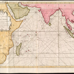
Carte de l'Océan Oriental ou Mer des Indes pour servir à l'Histoire Generale des Voyages
Permalink
https://digital.library.illinois.edu/items/482f0920-c278-0135-4a00-0050569601ca-7
This item is in the public domain.
Descriptive Information
| Title | Carte de l'Océan Oriental ou Mer des Indes pour servir à l'Histoire Generale des Voyages |
| Creator | Bellin, Jacques Nicolas |
| Date | 1754 |
| Dimensions | 35 x 48 cm |
| Cartographic Scale | 1:22,500,000 |
| Coverage-Spatial | Indian Ocean |
| Genre | Maps |
| Source | Atlas Maritime. |
| Physical Location | Professor Thomas Bassett Personal Collection |
| Bibliography | http://gallica.bnf.fr/ark:/12148/btv1b8491982t?rk=85837;2 |
| Map ID | afm0003320 |
| Rights | No Copyright - United States |
| Rights Description | This item is in the public domain. |
| Collection Title | Maps of Africa to 1900 |
| Repository | Rare Book & Manuscript Library |
| Type | Cartographic material |
| Collection | Maps of Africa to 1900 |
Download Options
|
Carte de l'Océan Oriental ou Mer des Indes pour servir à l'Histoire Generale des Voyages |
Contact us
for questions and to provide feedback.