
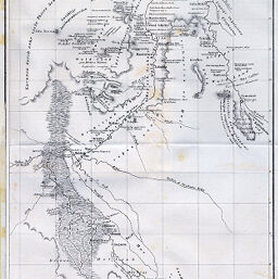
Der Obere Nil (nach V. Kloedens Karte) mit Hansal's Angaben entworfen und mit botanischen Namen versehen.
Permalink
https://digital.library.illinois.edu/items/48421450-e946-0133-1d3d-0050569601ca-1
This item is in the public domain.
Descriptive Information
| Title | Der Obere Nil (nach V. Kloedens Karte) mit Hansal's Angaben entworfen und mit botanischen Namen versehen. |
| Creator | Kotschy, Theodor |
| Date | 1858 |
| Dimensions | 39.5 x 24 cm |
| Cartographic Scale | 1:4,100,000 |
| Notes | Relief shown by hachures. Ferro meridian. Includes inset of area surrounding Gondokoro, Sudan. |
| Coverage-Spatial | Blue Nile River (Ethiopia and Sudan) |
| Subject | |
| Genre | Maps |
| Language | German |
| Color | Bitonal |
| Technique | Lithography |
| Source | Mitteilungen der Österreichischen Geographischen Gesellschaft, V. 2, between pp. 112-113. |
| Physical Location | stx |
| Map No. in Bassett and Scheven Bibliography | 225 |
| Call Number | 910_5GEOW |
| Map ID | afm0000225 |
| Rights | No Copyright - United States |
| Rights Description | This item is in the public domain. |
| Collection Title | Maps of Africa to 1900 |
| Repository | Rare Book & Manuscript Library |
| Type | Cartographic material |
| Collection | Maps of Africa to 1900 |
Download Options
|
Der Obere Nil (nach V. Kloedens Karte) mit Hansal's Angaben entworfen und mit botanischen Namen versehen. |
Contact us
for questions and to provide feedback.