
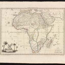
Afrique
Permalink
https://digital.library.illinois.edu/items/48ec8980-e946-0133-1d3d-0050569601ca-d
This item is in the public domain.
Descriptive Information
| Title | Afrique |
| Creator | Malte-Brun, Conrad, 1775-1826 |
| Date | 1812 |
| Dimensions | 22 x 30 cm |
| Place of Publication | Paris (France) |
| Cartographic Scale | 1:40,000,000 |
| Notes | Engraved by Chamouin and drawn by Giraldon. |
| Coverage-Spatial | Africa |
| Genre | Maps |
| Source | Atlas Complet Du Precis De La Geographie Universelle |
| Physical Location | Professor Thomas Bassett Personal Collection |
| Bibliography |
|
| Map ID | afm0003232 |
| Rights | No Copyright - United States |
| Rights Description | This item is in the public domain. |
| Collection Title | Maps of Africa to 1900 |
| Repository | Rare Book & Manuscript Library |
| Type | Cartographic material |
| Collection | Maps of Africa to 1900 |
Download Options
|
Afrique |
Contact us
for questions and to provide feedback.